
What is Rakaposhi?
Rakaposhi (Burushaski: رآکاپوش — meaning ‘Shining Wall’ or ‘Snow Covered’; also known locally as Dumani, meaning ‘cloud-covered’) stands at 7,788 meters (25,551 feet) above sea level, making it the 27th highest mountain in the world. Located in Nagar District, Gilgit-Baltistan, it rises from the Minapin Glacier in the Karakoram Range.
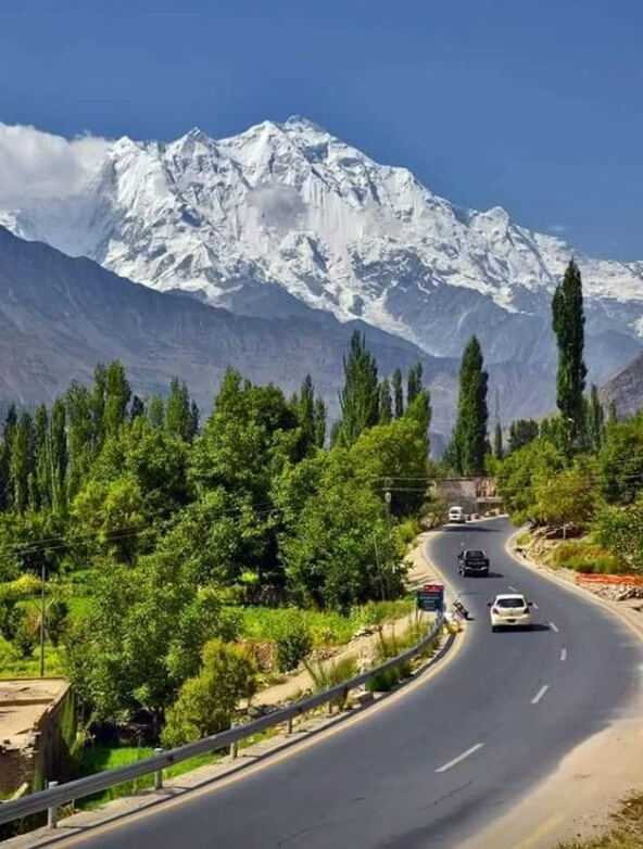
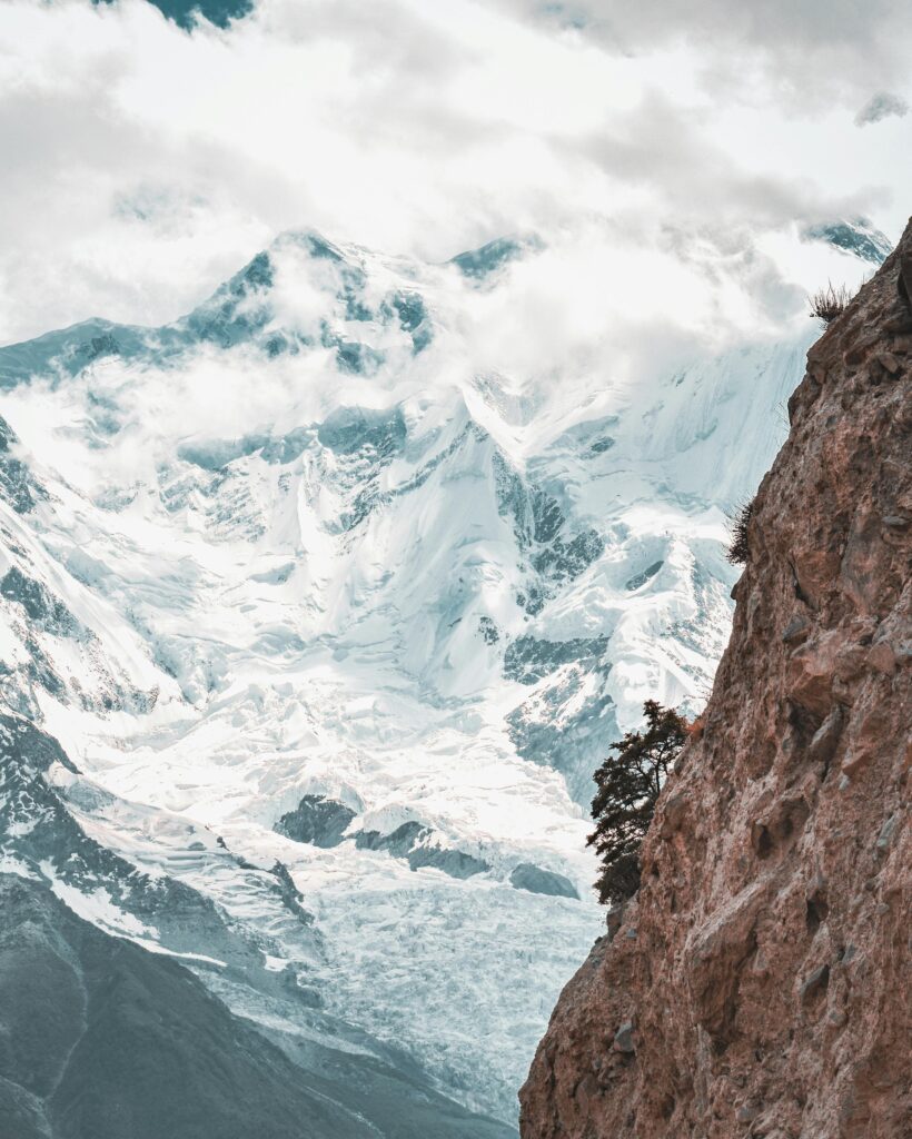
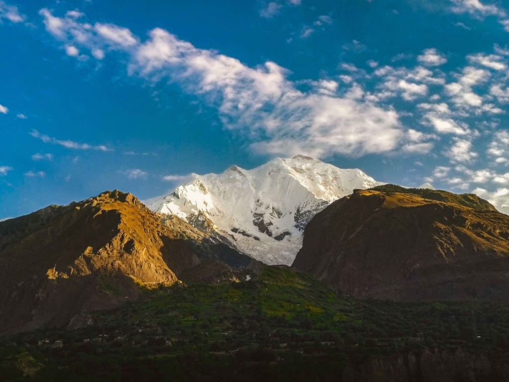
The numbers alone do not explain Rakaposhi’s extraordinary impact on those who see it. From the floor of the Hunza Valley near Minapin village, the mountain rises approximately 5,800 meters in a single, almost uninterrupted sweep — one of the greatest vertical rises from base to summit of any mountain in the world. And unlike K2, which is hidden deep in the Baltoro Glacier wilderness, Rakaposhi is visible from the Karakoram Highway. Driving north along the KKH through Nagar District, the mountain suddenly dominates the entire southern sky — a massive, symmetrical cone of ice and rock that appears to fill the horizon.
This visibility from the road has made Rakaposhi one of Pakistan’s most photographed mountains and one of the most frequently seen by international visitors passing through on their way to Hunza or Gilgit. But seeing it from a moving vehicle and spending time at its base are entirely different experiences.
The Best Free View on the Karakoram Highway
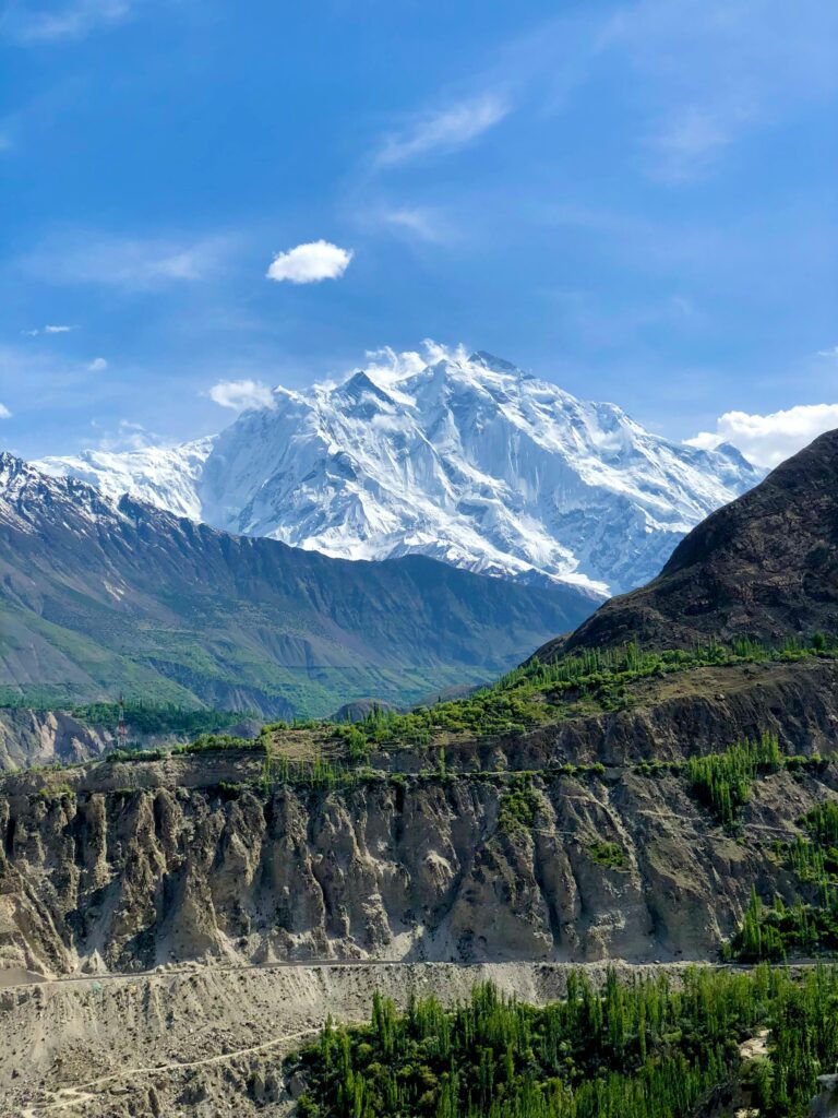
Approximately 50km south of Karimabad, the KKH passes through the village of Minapin in Nagar District — the closest the highway comes to Rakaposhi’s base. At this point, the full southern face of the mountain is visible in a single composition: the Minapin Glacier sweeping down from the summit to the valley, the fluted ridgelines on either side, the permanent snowfields, and the dramatic summit pyramid above. Multiple roadside viewpoints and tea stalls mark this stretch of the KKH.
The Rakaposhi Viewpoint — a specific pull-off with a small rest area and tea stalls — is at approximately kilometer marker 130 from Gilgit on the KKH. Every tour group traveling through Hunza stops here. For independent travelers, arriving at sunrise or sunset gives the best light and the fewest other people.
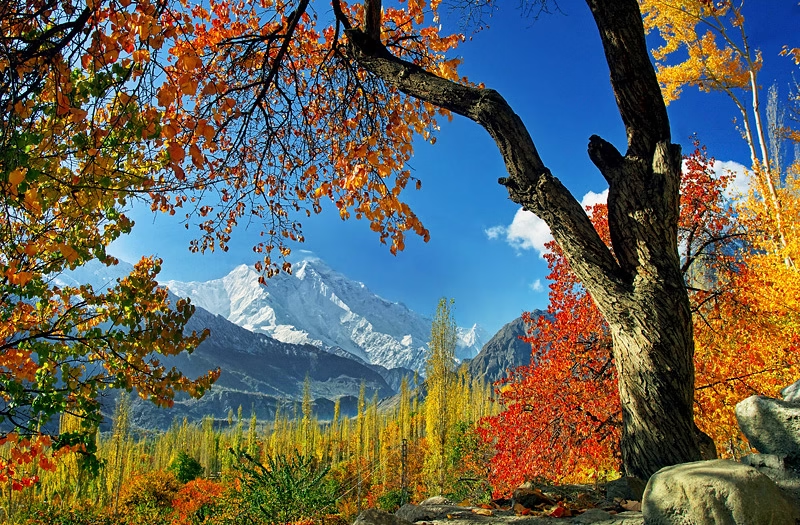
From Karimabad itself (approximately 35km north of Minapin), Rakaposhi dominates the southern skyline. The classical Hunza Valley composition — apricot orchards in the foreground, the ancient apricot terraces descending toward the valley, and Rakaposhi’s white wall in the distance — is the landscape that defines the region in most photography.
Rakaposhi Base Camp Trek — Complete Guide
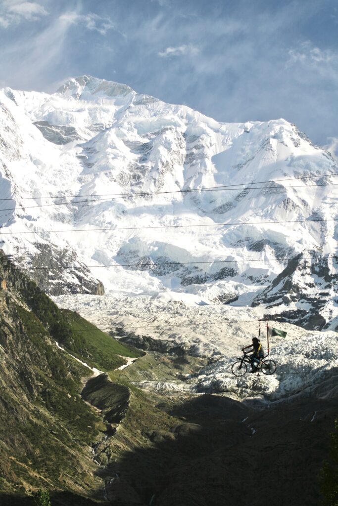
The trek to Rakaposhi Base Camp (locally called Tagaphari, 3,500m) is one of the most accessible high-altitude base camp treks in Pakistan. Unlike the K2 Base Camp trek (16+ days) or Nanga Parbat Base Camp (3–4 days from Fairy Meadows), Rakaposhi Base Camp can be reached in 2–3 days return from the Karakoram Highway, making it ideal for visitors with limited time who want a genuine high-altitude experience.
The trek starts from Minapin village (1,500m) — accessible directly from the KKH — and climbs through walnut and apricot orchards, pine and juniper forest, alpine meadows, and finally rocky glacial moraine to the base camp beside the Minapin Glacier.
Day-by-Day Itinerary
| Day | Route | Altitude | Duration | Character |
| Day 0 | Arrive Minapin from KKH; overnight at Diran Guest House | 1,500m | — | Arrival and preparation |
| Day 1 | Minapin village to Hapakun campsite | 2,800m | 3–4 hours (5.8 km, 800m gain) | Through orchards and pine forest; first views of Rakaposhi-Diran ridge |
| Day 2 | Hapakun to Tagaphari (Rakaposhi Base Camp) | 3,500m | 4–5 hours (steep section) | Alpine meadows, scattered juniper; full mountain view at ridge |
| Day 3 (optional) | Tagaphari to Diran Base Camp across glacier | 3,700m | 3–4 hours each way | Glacier crossing with crevasses; experienced trekkers only |
| Day 3/4 | Return to Minapin via same route | 1,500m | 5–6 hours | Downhill; faster return |
What You Will See
At Hapakun campsite (Day 1 end), a large meadow opens up with views of the lower glacier and the flanks of both Rakaposhi and Diran (7,266m). The shepherd families who spend summer here with their livestock operate a simple camp that provides meals (chapshuro, dal, rice) and tent or sleeping bag rental for approximately $15 per day — one of the most remarkably affordable and hospitable arrangements in Pakistan’s mountains.
At Tagaphari (Rakaposhi Base Camp), the view is the payoff: the Minapin Glacier fills the valley below, and the interconnecting ice wall between Rakaposhi and Diran fills the sky above. Both peaks are visible simultaneously. From surrounding ridges, the view extends across to the Hunza Valley and the distant Karakoram peaks beyond. At dawn, when the first light catches the summit ice while the valley remains dark, the light show is extraordinary.
An unusual feature of Rakaposhi Base Camp: there is a flat, grassy area large enough for cricket that locals call the ‘Natural Cricket Ground of Gilgit-Baltistan.’ Matches are apparently played here when shepherd communities gather in summer. It may be the highest cricket pitch in Pakistan.
Practical Information
| Detail | Information |
| Starting point | Minapin village, Nagar District (directly off KKH) |
| Getting to Minapin | Bus or shared van from Gilgit (1 hour) or Karimabad (30 min); get off at Minapin junction |
| Trek difficulty | Beginner to Moderate — no technical climbing required |
| Guide | Recommended; hire from Minapin village (~Rs 2,000–3,000/day) |
| Accommodation base | Diran Guest House, Minapin village (~Rs 1,500–2,500/night) |
| Camp accommodation | Shepherd huts at Hapakun and Tagaphari; tent + meals ~$15/day |
| Permit required | None for trekkers |
| Best season | Mid-May to October; June–September most stable |
| Trek distance | ~26 km round trip (base camp and back) |
| Total cost (3 days) | Approximately Rs 15,000–25,000 ($50–85 USD) including guide, food, and accommodation |
Climbing History
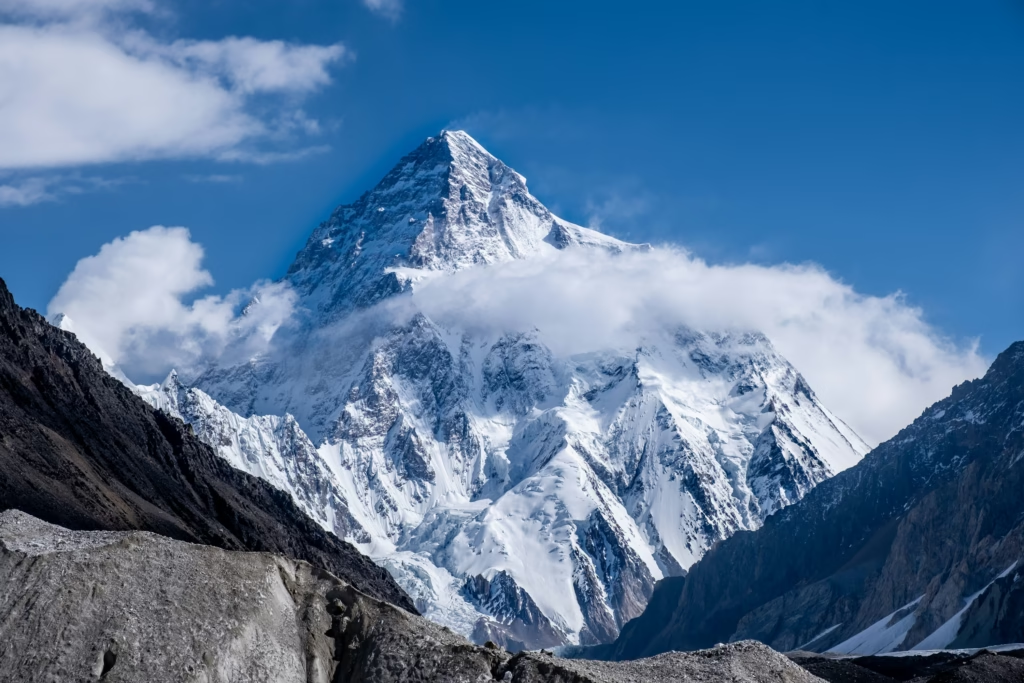
The first recorded attempt on Rakaposhi was made by British mountaineer A.F. Mummery in 1887, who reached approximately 6,000m before being forced to turn back. Multiple subsequent expeditions attempted the mountain over the following 70 years. The first successful ascent came on June 25, 1958, when British climbers Mike Banks and Tom Patey reached the summit via the Northwest Ridge — the standard climbing route.
As of 2025, approximately 50–60 successful summits of Rakaposhi have been recorded — a tiny number compared to popular 8,000m peaks. The mountain is considered technically demanding, with high avalanche risk on several routes. Organized summit expeditions start from approximately $3,990 per person through licensed Pakistani operators.
Rakaposhi for Non-Trekkers
Visitors who cannot or prefer not to trek to base camp can still experience Rakaposhi properly. The viewpoint at Minapin on the KKH provides a full-mountain view accessible from a standard vehicle. The Eagle’s Nest Hotel in Karimabad (40km north) has Rakaposhi in its skyline view. And the Nagar Valley road — driving south from Karimabad into Nagar — passes through villages where Rakaposhi’s north face fills the view from ground level. Even on a standard Hunza day trip, anyone passing through Nagar will see this mountain properly.

Related Destinations You Should Explore
- 🏔️ Nanga Parbat – The Killer Mountain
- 🏔️ K2 Mountain Pakistan: The Savage Beauty of the World’s Second-Highest Peak
1 comment
Your style is so unique compared to many other people. Thank you for publishing when you have the opportunity,Guess I will just make this bookmarked.2