
What is Nanga Parbat?
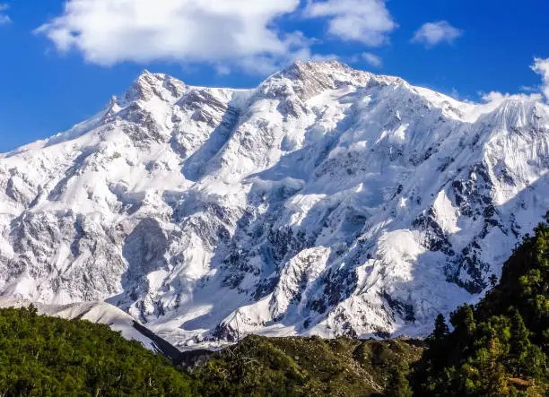
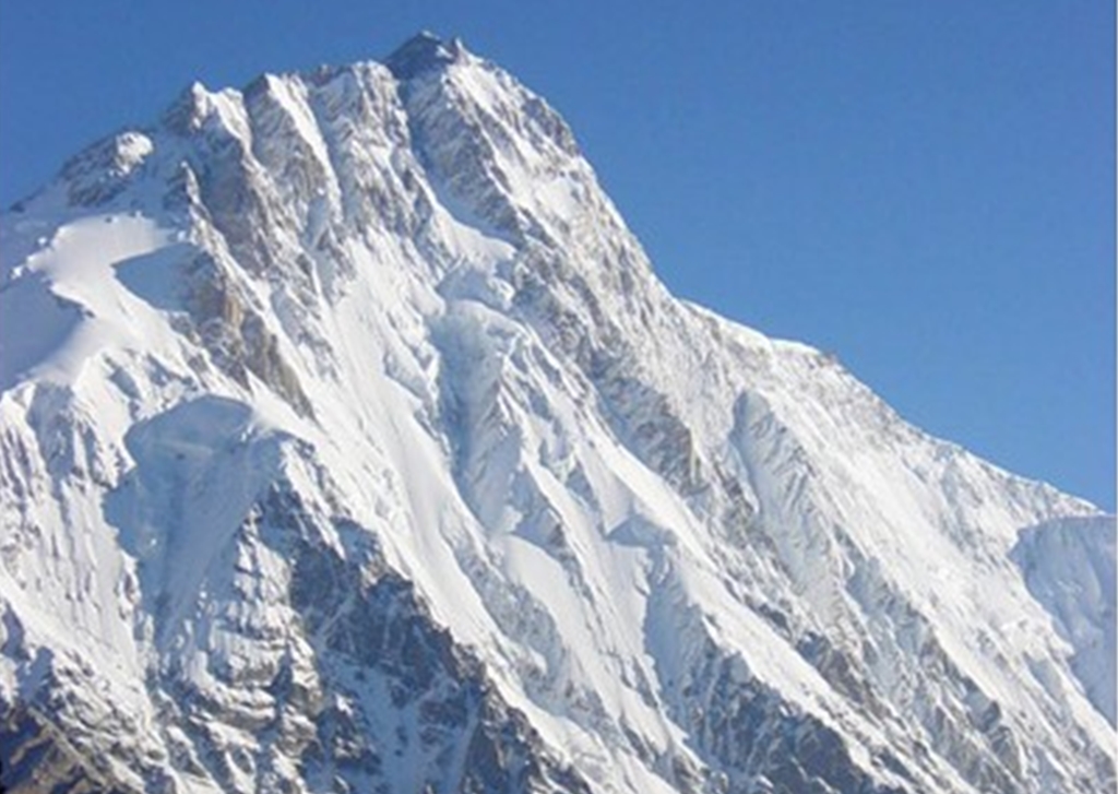
Nanga Parbat (Urdu: نانگا پربت — literally ‘Naked Mountain,’ from nanga meaning naked and parbat meaning mountain) rises to 8,126 meters (26,660 feet), making it the ninth highest mountain in the world. It sits at the far western end of the Himalayan Range in Diamer District, Gilgit-Baltistan — the westernmost of the world’s 14 eight-thousanders.
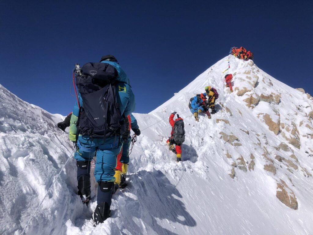
The mountain earned its notorious nickname ‘Killer Mountain’ from the 1953 German-Austrian expedition — the one that finally achieved the first summit — after decades of failed attempts, catastrophic storms, and deaths stretching back to the 1890s. With a historical fatality rate of approximately 21 deaths per 100 successful summits, Nanga Parbat is the third deadliest eight-thousander after Annapurna and K2.
Unlike K2 — which requires a week’s wilderness trek before you even see the mountain — Nanga Parbat is uniquely visible from the Karakoram Highway. Driving north through the Indus gorge, the mountain suddenly appears above the highway: a massive, isolated massif rising nearly 7,000 meters above the valley floor in a single, uninterrupted wall. This visual impact from the road — combined with the accessibility of Fairy Meadows — makes Nanga Parbat one of Pakistan’s most visited high-altitude destinations.
Death Rate and Statistics
| Statistic | Data |
| Height | 8,126 m (26,660 ft) |
| World ranking | 9th highest |
| Total summits (to 2025) | Approximately 3,317 |
| Total deaths | Approximately 90 |
| Historical fatality rate | ~21% (21 deaths per 100 summits) |
| Deadliness ranking | 3rd deadliest eight-thousander |
| First summit | July 3, 1953 — Hermann Buhl, solo |
The History That Made the Name
The Early Expeditions — A Long Trail of Tragedy
No mountain in history accumulated its death toll as painfully as Nanga Parbat did in the early 20th century. The first serious attempt came in 1895 when British mountaineer A.F. Mummery — the father of modern rock climbing — disappeared on the Diamir Face with two Gurkha companions. No trace of them was ever found.
In 1934, a well-funded German expedition led by Willy Merkl came close to the summit before being engulfed by a catastrophic storm. Nine people died, including Merkl himself, who perished after days of agony descending through the storm. Only Ang Tsering Sherpa survived, spending a week alone in the blizzard before reaching lower camps.
In 1937, another German expedition lost seven climbers and nine Sherpas when an avalanche buried their Camp IV during the night — the largest loss of life in mountaineering history at the time. By 1950, Nanga Parbat had a death toll of 31 — more than any other mountain — without a single summit.
1953 — Hermann Buhl’s Impossible Solo Summit
The first successful ascent of Nanga Parbat, achieved on July 3, 1953, is widely considered one of the greatest individual feats in mountaineering history — and possibly the greatest.
Austrian climber Hermann Buhl was part of a German-Austrian expedition led by Karl Herrligkoffer. On July 2, Buhl and three teammates set out for the summit from high camp. His companions turned back in deteriorating conditions. Buhl pressed on alone.
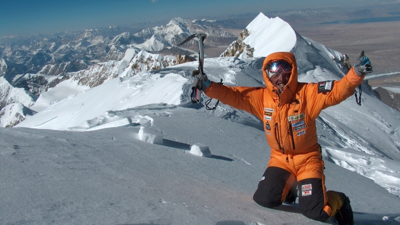
He reached the summit at 7:00 PM — far too late for a safe return. With no tent, no sleeping bag, and temperatures plunging to -30°C, Buhl spent the night standing on a small rocky ledge below the summit, leaning against the mountain face, dozing upright while gripping a handhold. He survived through sheer willpower and physical constitution. He descended the next day, severely frostbitten but alive, having been on the mountain for 41 hours straight. Many mountaineers who have studied this achievement in detail consider it the most extraordinary performance in the history of high-altitude climbing.
Key Milestones Timeline
| Year | Event |
| 1895 | A.F. Mummery disappears on the Diamir Face — first fatalities on the mountain |
| 1934 | Willy Merkl expedition; 9 die in catastrophic storm including Merkl himself |
| 1937 | Avalanche destroys Camp IV; 16 killed — deadliest mountaineering accident of its era |
| 1953 | FIRST SUMMIT: Hermann Buhl, solo, July 3. One of mountaineering’s greatest achievements |
| 1970 | Reinhold Messner and brother Gunther summit via Rupal Face; Gunther dies on descent |
| 2013 | Taliban attack kills 11 international climbers at Diamir Base Camp |
| 2018 | First solo winter ascent by Spanish climber Alex Txikon |
The 2013 Massacre — A Different Kind of Danger
In the early hours of June 23, 2013, a group of gunmen disguised as policemen attacked the Diamir Base Camp of Nanga Parbat, killing 11 mountaineers from Ukraine, China, Slovakia, Lithuania, Nepal, and China — along with their Pakistani cook. It was the deadliest attack on mountaineers in history and sent shockwaves through the international climbing community. The Pakistani Taliban claimed responsibility. Security on Nanga Parbat expeditions was dramatically increased following this event, and the mountain’s base camps are now monitored more closely by Pakistani security forces.
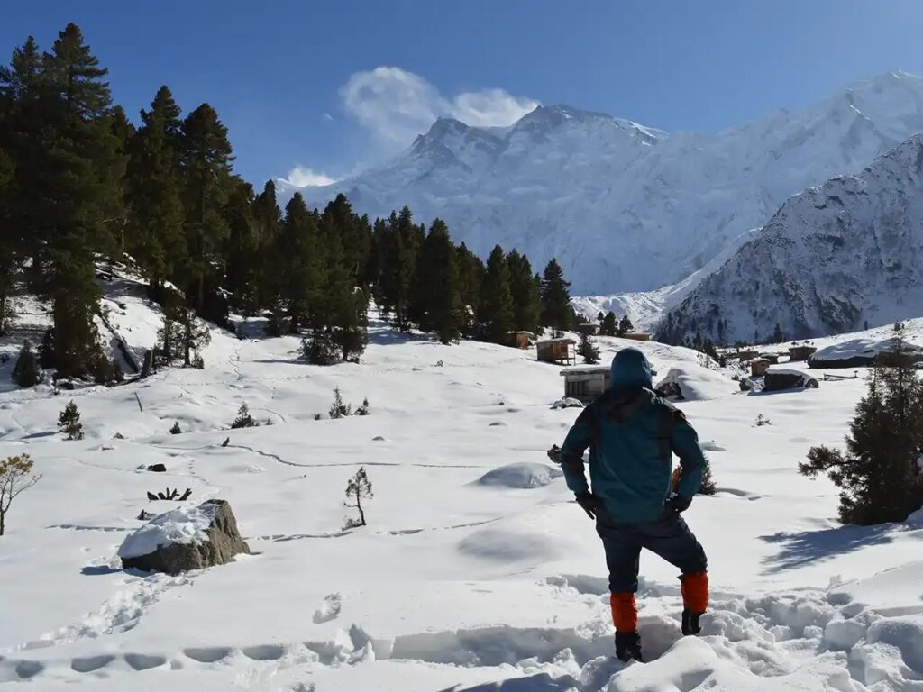
Fairy Meadows — Pakistan’s Most Accessible High-Altitude Paradise
What is Fairy Meadows?
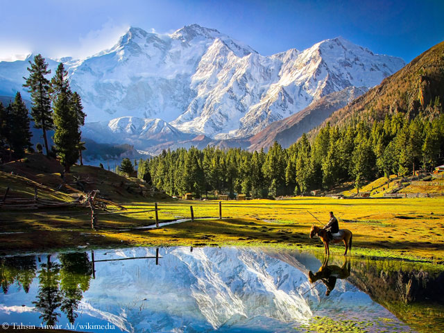
Fairy Meadows (elevation: 3,306m) is an alpine plateau with direct, unobstructed views of Nanga Parbat’s massive Raikot Face. It is one of Pakistan’s most famous tourist destinations — and the most accessible major high-altitude viewpoint in the entire country. The name was given by German climbers in the 1930s; it appears on no map by that name, but the designation stuck. In summer, the meadow is an explosion of wildflowers and green grass, with the snow-and-ice wall of Nanga Parbat’s north face dominating the horizon.
In terms of sheer visual impact per unit of effort required, Fairy Meadows may be the best value viewpoint in all of the Himalayas and Karakoram. A 3–5 hour walk from Tato village brings you to one of the most spectacular mountain views on Earth.
Getting to Fairy Meadows
| Step | Route | Time/Distance |
| 1 | Islamabad to Gilgit by road via KKH | ~18–20 hours by bus or overnight coach |
| 1 alt | Islamabad to Gilgit by domestic flight | ~45 minutes (weather dependent) |
| 2 | Gilgit to Raikot Bridge on KKH | ~3–4 hours by bus or shared van |
| 3 | Raikot Bridge to Tato village by 4WD jeep | ~1 hour on one of Pakistan’s most vertigo-inducing roads |
| 4 | Tato village to Fairy Meadows on foot | 3–5 hours walk through pine forest (8–10 km) |
The jeep road from Raikot Bridge to Tato is genuinely terrifying — a narrow, unpaved track cut into a cliff face with sheer drops and no guardrails. Local drivers handle it daily with skill. This is not a road for anyone with a serious fear of heights, but the drivers know every meter of it.
Fairy Meadows vs Nanga Parbat Raikot Base Camp
| Feature | Fairy Meadows | Nanga Parbat Base Camp (Raikot) |
| Altitude | 3,306m | 4,200m |
| Difficulty | Easy forest walk (3–5 hrs from Tato) | Moderate trek (6–8 hrs from Fairy Meadows) |
| Accommodation | Wood cabins and guesthouses available | Tents only |
| Best for | Families, photographers, casual visitors | Experienced trekkers |
| Cost | Rs 1,500–3,000/night including meals | Self-sufficient camping |
| Season | May to October | June to September |
Cost of Visiting Fairy Meadows — 2026
| Item | Cost (PKR) |
| Bus Islamabad to Raikot Bridge (return) | ~Rs 4,000–6,000 |
| Jeep Raikot Bridge to Tato (shared) | ~Rs 500–800 per person |
| Jeep Tato (private, return) | ~Rs 3,000–5,000 |
| Accommodation at Fairy Meadows (per night with meals) | ~Rs 1,500–3,000 |
| Guide (optional but recommended) | ~Rs 1,500–2,500/day |
| National Park entry fee | ~Rs 200–500 |
| Total 3-day trip from Gilgit | ~Rs 8,000–20,000 (~$30–70 USD) |
Reinhold Messner and His Brother — The Rupal Face Tragedy
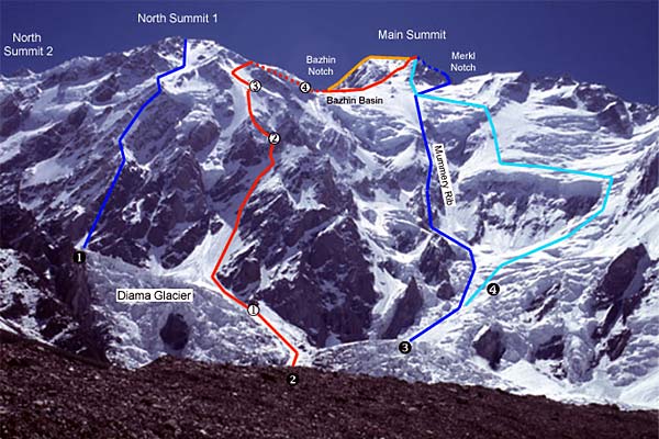
In 1970, legendary Italian mountaineer Reinhold Messner and his younger brother Gunther became the first to climb Nanga Parbat’s colossal Rupal Face — at 4,500 meters of vertical relief, the highest rock and ice face in the world. They reached the summit on June 27, 1970, but in their descent, Gunther showed signs of serious altitude sickness. Unable to descend the Rupal Face safely with his incapacitated brother, Reinhold chose to descend the Diamir Face — unknown territory, without a map or supplies.
Gunther Messner was killed by an avalanche near the bottom of the Diamir Face. Reinhold descended alone, severely frostbitten, and eventually reached a Pakistani village after several days of wandering near-delirious. He lost several toes and a finger to frostbite. The tragedy haunted Reinhold Messner for decades, and he later returned to the Diamir Face to search for his brother’s remains — eventually finding bone fragments and a boot in 2005, 35 years after the accident.
Photography Tips at Fairy Meadows
- Best light: Sunrise, when Nanga Parbat’s east face catches the first gold of morning against a dark sky. Arrive at the viewpoint 30 minutes before sunrise.
- Sunset alpenglow: The west-facing Raikot Face glows orange-pink in the last hour of daylight. Another essential shot.
- Wildflowers: July is peak bloom — the meadow fills with alpine flowers, providing foreground for mountain shots.
- Milky Way: The darkness at Fairy Meadows is extraordinary. On a clear, moonless night, the Milky Way is vivid above the mountain silhouette. A wide-angle lens and tripod are essential.
- Drone: Regulations require prior permission but aerial footage of Fairy Meadows and Nanga Parbat is spectacular. Ask guides about current restrictions.
1 comment
You must take part in a contest for the most effective blogs on the web. I will recommend this website!